- EraRoman-Islamic
- Project DirectorPeter Sheehan & Kamel Hefny
- LocationOld Cairo
- AffiliationAmerican Research Center in Egypt (ARCE)
- Project SponsorUSAID
- Project Dates1998-2006
- Project ImplementerARCE
Old Cairo is defined by the boundaries of the city’s original Roman core, known as Babylon. Present-day Old Cairo is still anchored by the remains of the Roman fortress and surrounded by the early Islamic and medieval sites that grew around the Roman settlement after the Arab conquest of Egypt in 641 CE. It is a densely packed neighborhood with some of Egypt’s most renowned sites and archaeological remains. The earliest record of Babylon in Egypt dates back to 50 CE, when the Roman writer Diodorus Siculus described captives from Babylonia who “seized a strong position on the banks of the river” and upon being granted amnesty “established a colony on the spot which they also named Babylon, from their native land.” It was not until 302 that the fortress was constructed by emperor Diocletian as part of a military strategy to assert Roman rule in Egypt, which lasted 340 years until the Arab conquest.
After laying siege to Babylon’s fortress for seven months, the Arab army set up camp east of the fortress at the site of al-Fustat. One of the first monuments established by the new rulers was the mosque of Amr ibn al-‘As, north of the fortress of Babylon. The mosque has undergone numerous renovations over time, but the present building still stands on the original site today. The Egyptian Church also flourished under early Muslim rule and the Coptic Patriarchate eventually moved its residence to Old Cairo in 1047. Until 1517, Cairo was ruled by a succession of Muslim dynasties: Umayyads, Abbasids, Tulunids, Fatimids, Ayyubids and Mamluks. During this time, the city spread northward from the original core of the Roman city. By the time the Ottomans entered Egypt in 1517, the boundaries of medieval Cairo contained an impressive number of monuments, including the citadel of Salah al-Din, the Nilometer and the mosque of Ibn Tulun.
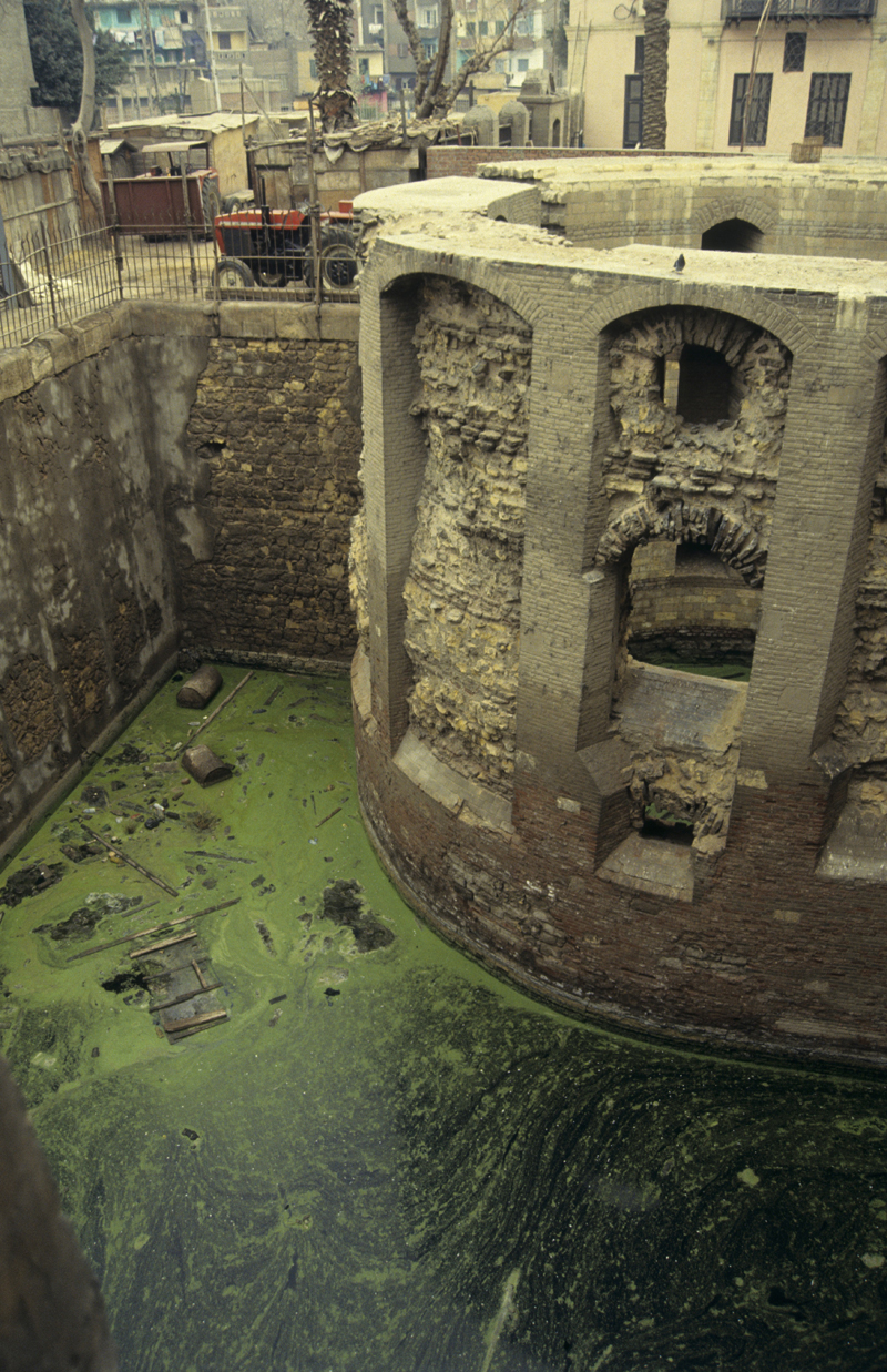
The walled zone of Old Cairo also contains many of Egypt’s oldest and most significant monuments, like the Hanging Church, the churches of Abu Serga and St. Barbara, the convent of St. George, parts of the original Roman fortress and the Ben Ezra Synagogue. These sites are invaluable as they represent the earliest years of urban Cairo and illustrate the diverse social and cultural identity and history of the city. However, by the late 20th century, the whole neighborhood was endangered by high levels of groundwater that had seeped into the lower foundation levels of the historic buildings and threatened the homes and welfare of the modern-day inhabitants.
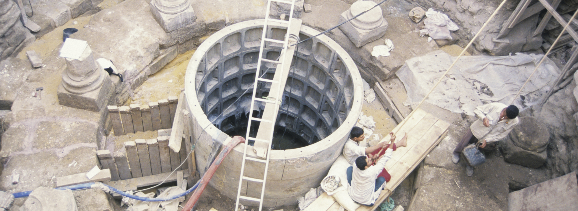
Recognizing these irreplaceable cultural assets were at risk, the U.S. Agency for International Development (USAID) allocated funds for an Old Cairo groundwater lowering project in 1999. The American Research Center in Egypt also received funding from USAID to carry out a major collaborative role in the project from 2000 to 2006, by conducting archaeological monitoring, documentation and recording, side-by-side with the groundwater lowering engineers. This interdisciplinary partnership between heritage and engineering professionals was the first of its kind in Cairo.
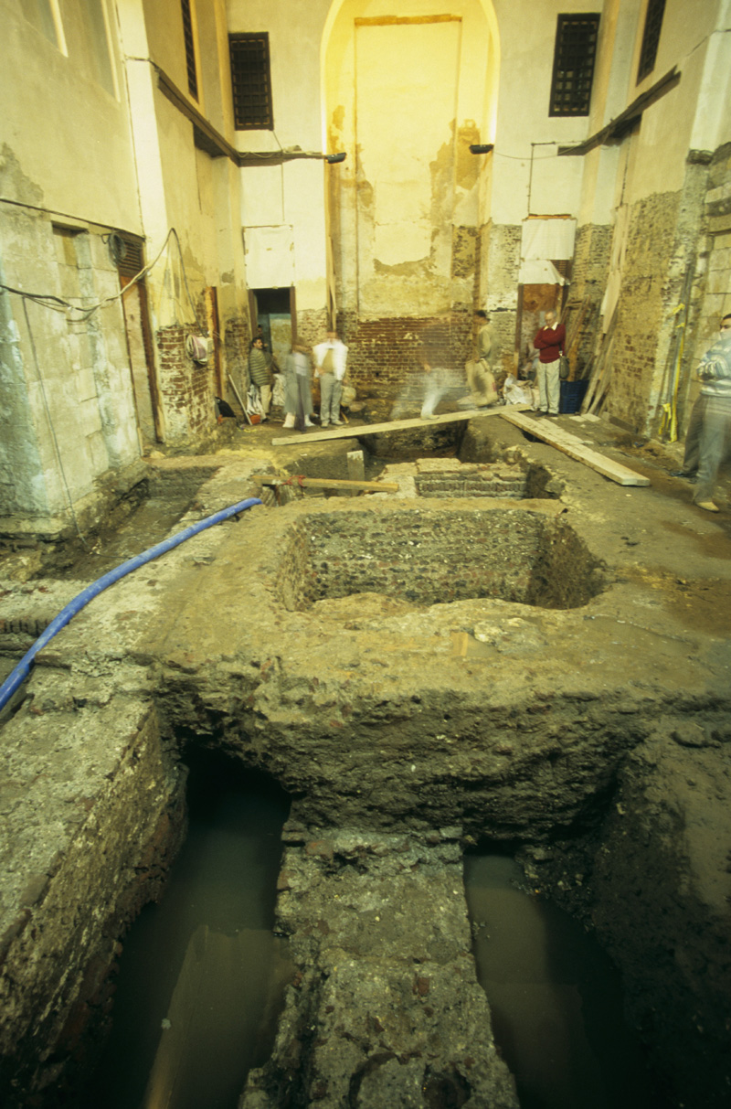
The monitoring work required an experienced archaeological team to document and excavate any archaeological deposits threatened by extensive digging from the engineering work. Experts monitored borings, test pits, dewatering shafts, open trenches and manhole and drainage pipe installations. Many of these reached 33 feet (10 meters) beneath the modern ground level, which is far below the Roman street levels lying 10-16 feet (three to five meters) under the modern city. On-site teamwork and cooperation, as well as regular appraisals of the construction work by a team of archaeologists, prevented damage to the buried archaeological remains.
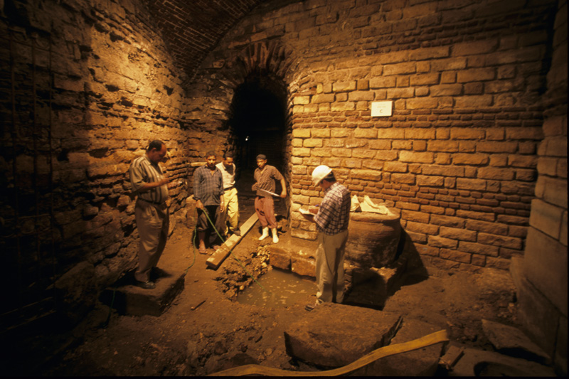
Regular progress reports monitored and documented significant areas and buildings. The six-year project recorded abundant archaeological finds, including remains of well-preserved Roman walls and barracks adjacent to the Ben Ezra Synagogue; early Roman harbor installations in front of the remains of the south gate of the fortress and numerous small finds such as ceramics, fabrics and human bones. Additionally, project director Peter Sheehan’s book, Babylon of Egypt, made much of the collected, analyzed and mapped archaeological data publicly available.
The alliance between conservation and construction work in this project showed how, in archaeologically significant areas like Old Cairo, the demands of modern infrastructure and the documentation and preservation of the past can coexist, and even be mutually beneficial. In this respect, the archaeological monitoring of Old Cairo was a notable milestone in urban conservation and development work in Egypt. This model has now established a tried and true formula that can be applied to future construction and engineering development projects across the historic districts of the country.
CategoryARCE ProjectsTopicsArchaeology, HistoryThemeArchaeological Sites, Islamic CairoHistoric PeriodIslamicLocationCairo, Lower Egypt